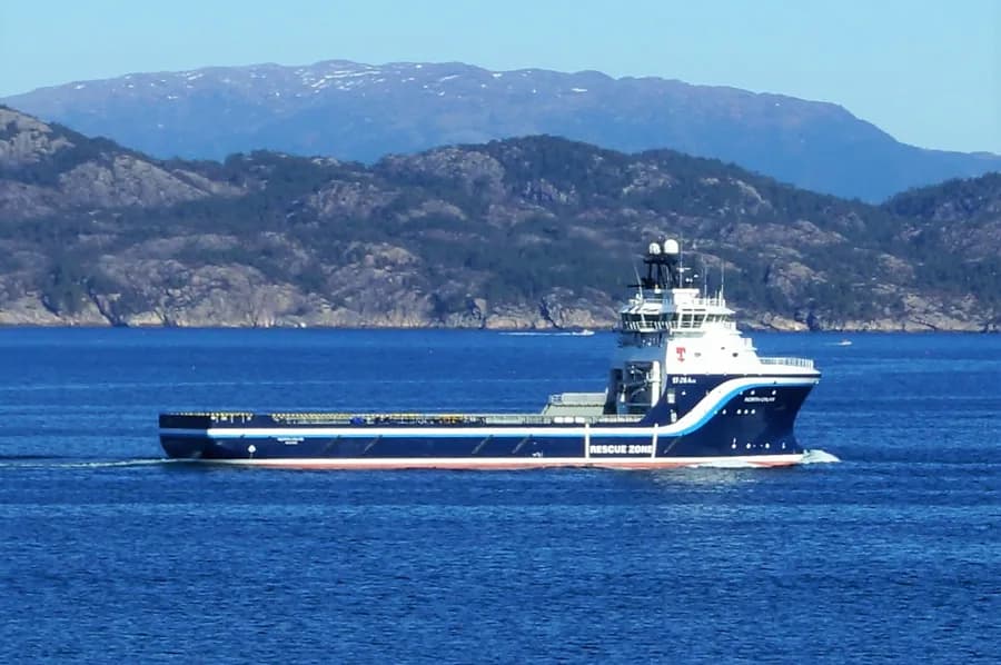
- IMO
- 9654098
- MMSI
- 257184000
- Call Sign
- LDGE
Technical Specifications
Key Figures
Live Tracking
Current Position
Where it waited most
Most time stopped at Mongstad — 5 d across 6 stays.
- 1Mongstad5 d · 6×
- 2Offshore 60.49,2.8312 h · 4×
- 3Offshore 61.28,1.8810 h · 4×
- 4Offshore 60.54,3.056 h · 2×
- 5Offshore 61.10,2.284 h
- 6Offshore 61.20,2.203 h
- 7Offshore 60.61,2.772 h · 2×
Derived from the AIS track — runs of near-zero speed (anchored, moored or drifting) snapped to the nearest port. Builds up as we observe the vessel.
Intelligence
Risk & Sustainability
- MongstadbaseIn portJun 30, 2026
- Mongstadbase3.2 dJun 26, 2026
- Mongstadbase0.4 dJun 24, 2026
- Mongstadbase0.4 dJun 20, 2026
- Mongstadbase0.2 dJun 18, 2026
AIS-derived from our live feed.
Operational Status
Activity
Making way at sea speed on its latest broadcast.
Read from the single most-recent AIS broadcast we hold for this hull — we keep no position history, so this is a point-in-time posture, not a dwell inference. Derived in-house from our own AIS feed; weight it by the broadcast age above.
Port calls
3 recent · AIS-detectedArrivals, time in port and the load/discharge inferred from the draught change — detected from AIS track history. An open call means the vessel is still in port (no departure observed yet).
- no cargo change→ · 5 h in port· draught 6.2→6.0 m
- Loaded→ · 10 h in port· draught 5.8→6.5 m
- no cargo change→ · 9 h in port· draught 6.0→6.0 m
Method: each call is a run of fixes inside a port’s geofence confirmed by a stop (or an AIS gap); load/discharge is the sign of the draught delta over the call. Indicative — arrivals before our AIS history began read from the first observation.
Where it waits
1 port · 24 h totalTime-in-port summed by port from the AIS-detected port-call history — the ports this vessel has spent the most time at, longest first.
- Mongstadbase· Norway24 h3 calls · 8 h avg 1 load
Based on 3 completed calls observed since — open calls (no departure yet) are excluded. The distribution sharpens as AIS history accrues.
Composite Risk
Risk Score
Multiple adverse factors, or a hard ship-specific signal, lift this hull above the fleet norm.
A coverage-weighted blend of the 3 components we could read for this hull — the weights renormalise over only the components present, so a thin read is never inflated and a hull is never credited a “safe 0” for a signal it has no row for. Higher means riskier. Derived in-house from government-open port-State-control, flag, sanctions and our own vessel data; weight it by the coverage above.
Estimated
Capacity & Classification
Other · summer draught 6 m · 12.5 t per cm immersion
Estimate only — modelled from deadweight (hull geometry) using a first-principles hydrostatic model, not measured hydrostatic tables. The design draught it is anchored to is unreliable across the fleet.
Commercial
Voyage Estimate
Fleet Management
Ownership & Management
Visual Archive
Gallery
Explore More
Similar Vessels
Community
Vessel Comments