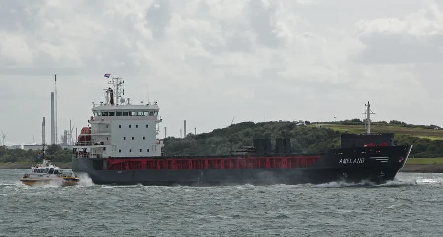
- IMO
- 9508794
- MMSI
- 246629000
- Call Sign
- PBVF
Technical Specifications
Key Figures
Live Tracking
Current Position
Where it waited most
Most time stopped at Kastos Island — 32 h across 3 stays.
- 1Kastos Island32 h · 3×
Derived from the AIS track — runs of near-zero speed (anchored, moored or drifting) snapped to the nearest port. Builds up as we observe the vessel.
Intelligence
Risk & Sustainability
- AER (CO₂/capacity·nm)
- 19.3
- Fuel burned
- 2,100 t
- Technical
- EEXI (10.2 gCO₂/t·nm)
Verified reported figure. Band is peer-relative, not official IMO CII.
- Kastos Island1.9 dJun 29, 2026
- Porto San Vitale0.2 dJun 26, 2026
- Porto San Vitale0.3 dJun 20, 2026
AIS-derived from our live feed.
Operational Status
Activity
Stopped, anchored or moored on its latest broadcast — parked, not necessarily withdrawn.
Read from the single most-recent AIS broadcast we hold for this hull — we keep no position history, so this is a point-in-time posture, not a dwell inference. Derived in-house from our own AIS feed; weight it by the broadcast age above.
Composite Risk
Risk Score
Some elevated factors — typically age or a lower-graded flag — but no acute ship-specific flag.
A coverage-weighted blend of the 2 components we could read for this hull — the weights renormalise over only the components present, so a thin read is never inflated and a hull is never credited a “safe 0” for a signal it has no row for. This headline is flagged low-confidence (a thin or structural-only read) and should not be treated as a verdict. Higher means riskier. Derived in-house from government-open port-State-control, flag, sanctions and our own vessel data; weight it by the coverage above.
Estimated
Capacity & Classification
Other · summer draught 6.9 m · 15.9 t per cm immersion
Estimate only — modelled from deadweight (hull geometry) using a first-principles hydrostatic model, not measured hydrostatic tables. The design draught it is anchored to is unreliable across the fleet.
Commercial
Voyage Estimate
Visual Archive
Gallery
Explore More
Similar Vessels
Community
Vessel Comments